


Navigation* - traffic information
TMC (Traffic Message Channel) is a standardised coding system for traffic information. The receiver automatically searches for the correct frequency.
Note
The traffic information is presented differently depending on whether the destination is specified or not specified.

This symbol on the screen indicates that traffic information is available within the current reception area. Symbol colour indicates the importance of the information:
- RED - the information is read out and the position is shown on the map.
- YELLOW - no reading out, the position is shown on the map.

This symbol marks the position of a traffic problem, for more information, see section Traffic information - with specified destination > Traffic information on map.
Note
Traffic information is not available in all areas/countries.
The traffic information transmission areas are constantly being expanded.
Traffic information - without specified destination
The function allows you to show traffic problems without the destination having been selected.
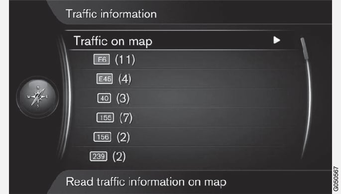
Traffic information on map
All traffic
Traffic information - with specified destination
The function shows traffic problems when the destination has been entered.
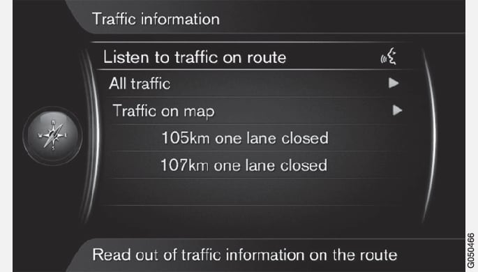
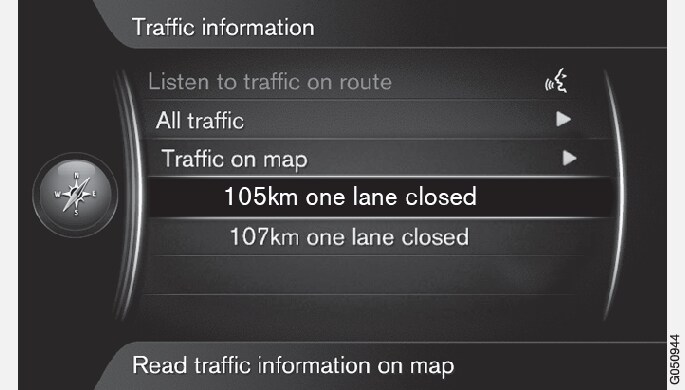
Listening to traffic information along the route
All traffic
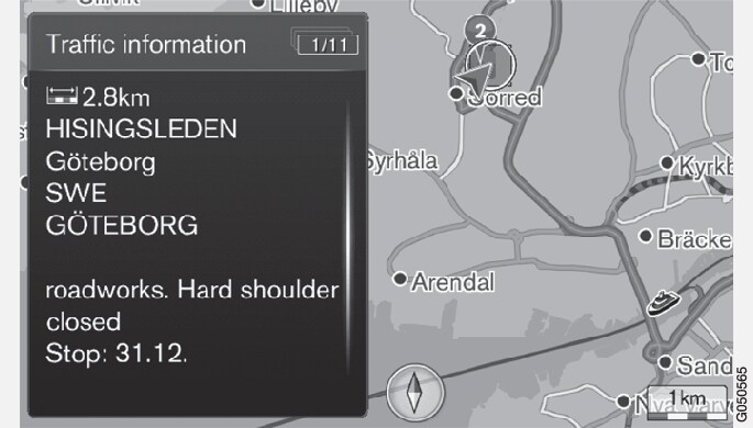
Additional information about the traffic problem is shown, as well as position on map. The map image is centred around the position of the traffic problem.
Traffic information on map
Available information is shown, e.g.
- street name/road number
- country
- nature of the problem
- extent of the problem
- duration of the problem.
If there are several traffic problems within the crosshair frame then the one closest to the centre of the crosshair is shown first.
Figures such as "2/5" in the upper part of the screen mean that the information shown is number 2 of a total of 5 messages within the crosshair - remaining messages are browsed to using repeated short presses on OK/MENU.
Direct listed information
Additional information about the traffic problem is shown, as well as position on map. The map image is centred around the position of the traffic problem.
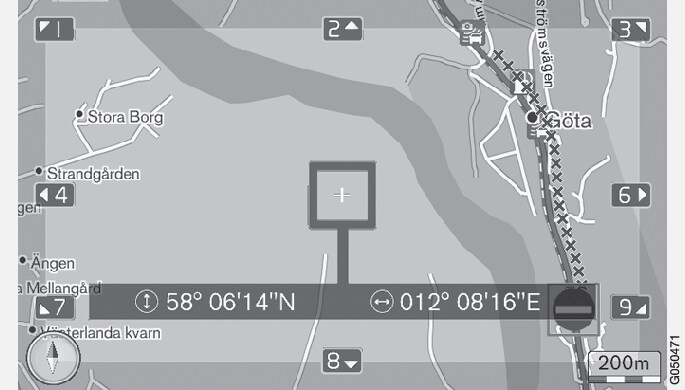
Extent of traffic problem
Certain traffic problems are not just tied to one single position, but can cover a longer section.
In addition to the symbol for the position of the traffic problem, the current distance is also highlighted with a row of red crosses "xxxxx".
- The length of the highlighting corresponds to the extent (distance) of the traffic problem.
- Driving direction is indicated by the side of the road that is highlighted.
Size of area for traffic information
The map scale determines how much traffic information can be shown. The larger the map area that is shown on the screen, the greater the number of traffic disruptions that can be shown.