Internet map – on-screen text and symbols
This article provides an explanation of the text and symbols used on the screen.
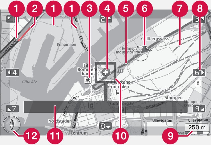
 | Type of road (size and color vary according to the size of the road and the map scales/colors being used) |
 | Traffic information: indicated by a line by the side of the road |
 | Point of interest (POI) |
 | Symbol for final destination |
 | Planned route (blue) |
 | Vehicle's current location |
 | Railroad |
 | Keys (on the center console keypad) for scrolling/moving the map in the directions indicated by the arrows |
 | Map scale |
 | Magnifier and crosshairs |
 | Name of the current road/street, coordinates or information about a point of interest (POI) |
 | Compass |