Traffic information
Note
Traffic information is not available in all areas/countries.
Coverage areas for traffic information are being increased continuously.
The "Traffic settings" section describes the adaptations that can be made to display traffic-related information on the map.

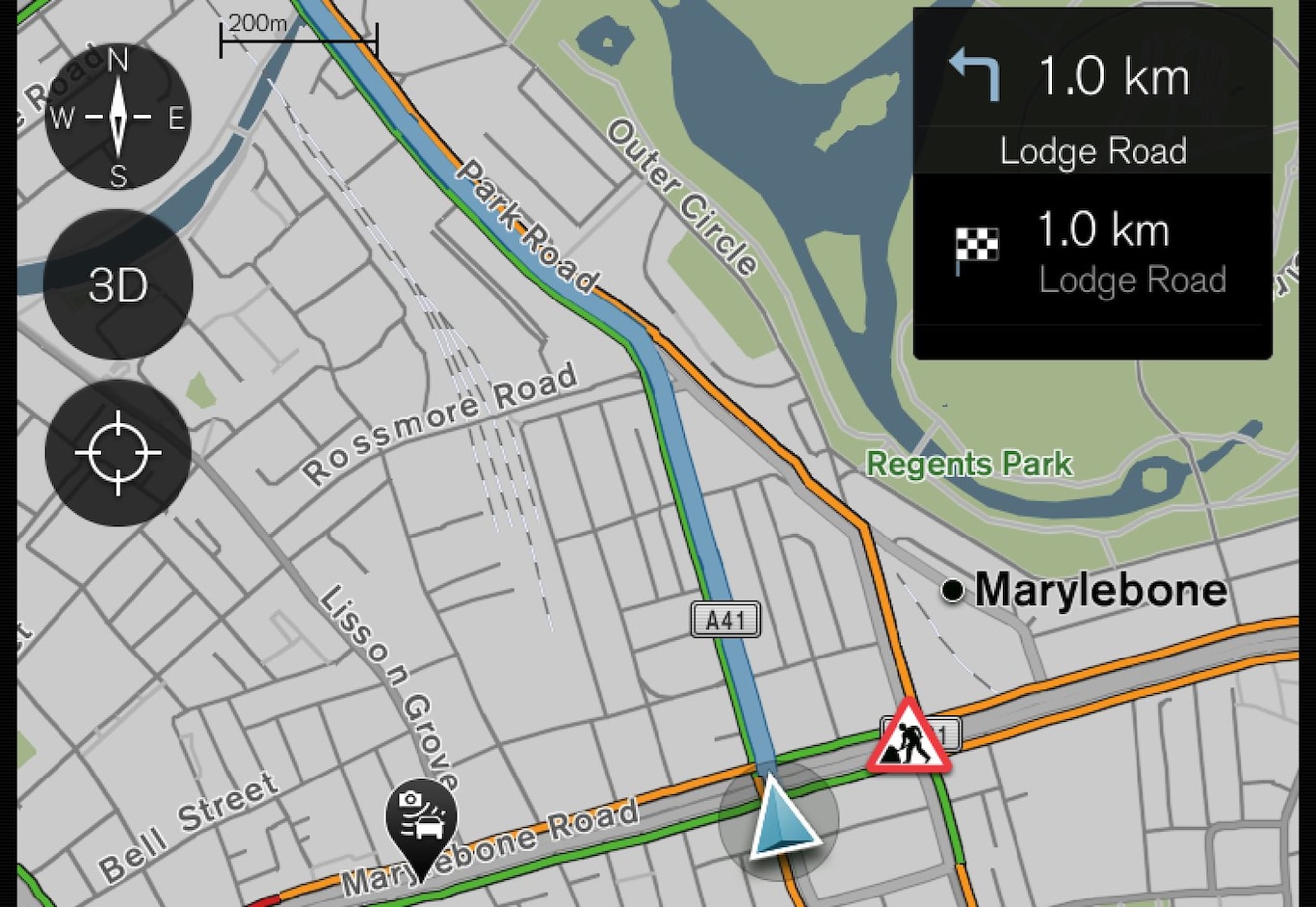
Traffic disturbances such as compact and slow traffic, road works, accidents etc. are shown with different symbols on the map.
When disturbances are more severe their extent is also shown with a RED line along the side of the road, e.g. in the event of road works. The line indicates at the same time in which travel direction the disturbance applies - if the disturbance is in both directions the road section is marked with a line on both sides.
Information on traffic disruptions
Avoid traffic disruptions
If the disturbance is situated on the route the Avoid option can be selected. The system then calculates an alternative route.
For a description, see "Traffic disruptions along the route".
Real Time Traffic Information (RTTI)1
With an Internet-connected car, real time traffic information can be received via the Internet with RTTI.