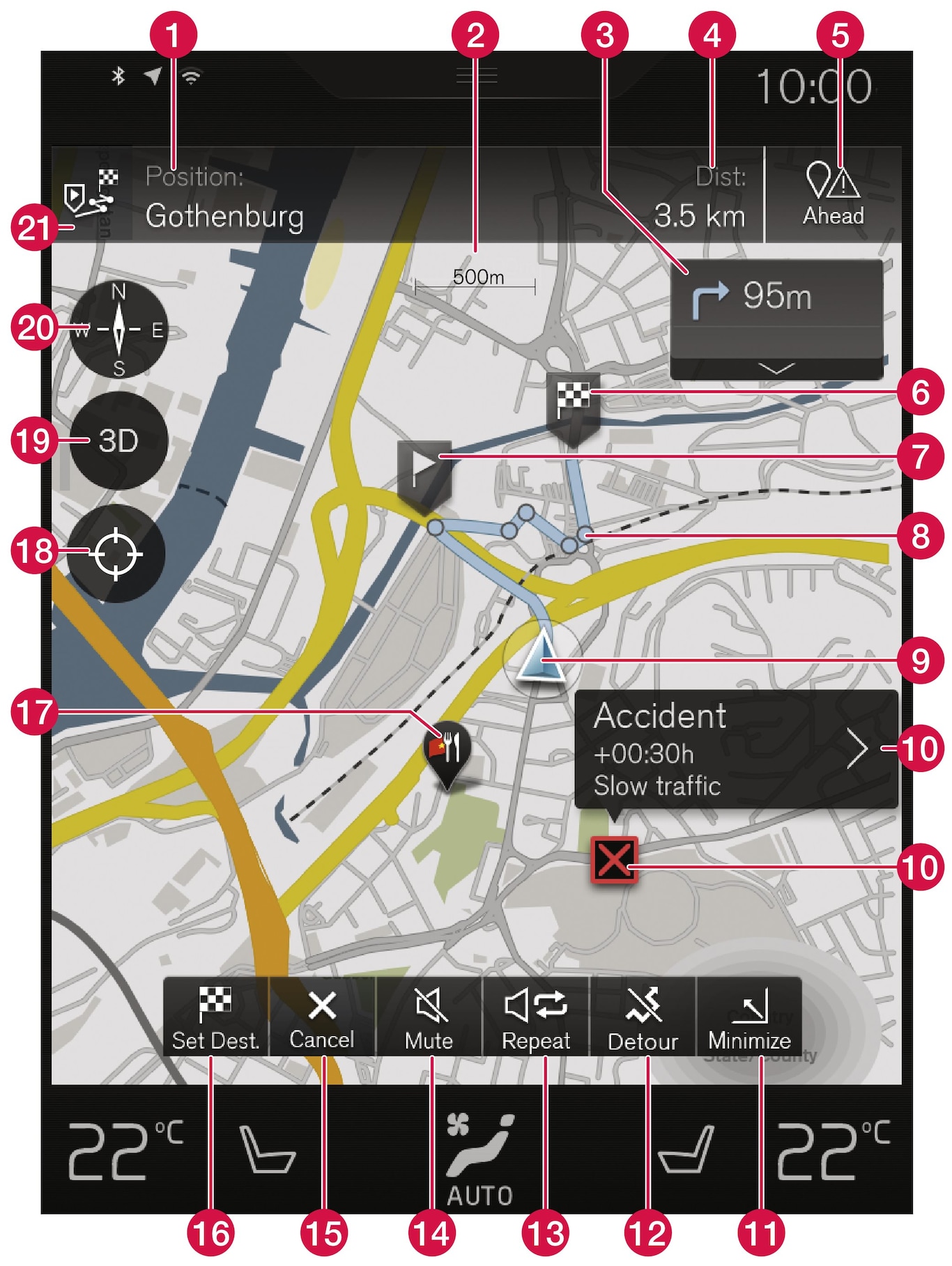
| Text and symbols on the map | |
 | The car's current position |
 | Map scale |
 | List with the itinerary's guidance points |
 | Destination and time of arrival/remaining time to arrival, or current position and distance to destination |
 | List of the itinerary's points of interest (Point of Interest - POI) and traffic information |
 | Destination/final destination |
 | Intermediate destination |
 | Guidance point |
 | Car on planned route |
 | Traffic information |
 | Minimises (expanded view) or maximises the map image (full screen) |
 | Calculate detour |
 | Repeat the current voice guidance |
 | Voice guidance temporarily On/Off |
 | Cancels guidance |
 | Specifying destinations/intermediate destinations |
 | Point of interest (Point of Interest - POI) (restaurant) |
 | Reset the map to follow the car |
 | Changes map display between 2D and 3D |
 | Compass + Changes between north and travel direction up |
 | Itinerary and Alternative route |